
Quick answer
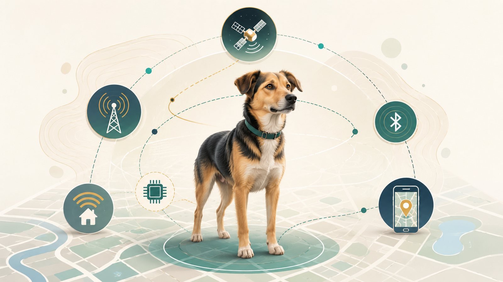
Pet location technologies do different jobs. A passive microchip supports identification only after someone scans it and a registry workflow connects its number to current owner contact information. Global Navigation Satellite Systems (GNSS), including GPS, calculate position, but a separate communication path is needed to deliver a remote update. Bluetooth can support nearby finding; crowd-assisted mechanisms documented by Apple Find My and the Tile Network can relay a location through participating devices; and cellular or another documented radio path can carry updates to an owner-facing service. These layers may complement one another in some situations, but none is a universal replacement for the others.
Key facts
Swipe horizontally to see all columns.
| Technology layer | Evidence-safe boundary |
|---|---|
| Passive microchip | Supports identification after a scan and registry lookup; it does not provide live location. |
| GNSS or GPS | Calculates position; a separate reporting path is needed to deliver a remote update. |
| Bluetooth | Supports nearby finding or a documented crowd-assisted workflow; behavior depends on the exact platform and implementation. |
| Cellular or another radio path | Carries updates within the documented product architecture; coverage and latency are not guaranteed. |
| Evidence limit | No tracker, subscription, scanner, or crowd-finding platform was directly tested for this article. |
Start with the job-identification, positioning, nearby finding, relaying, or remote reporting-then verify the dependencies of the exact product or workflow.
The most useful first question is not “Which tracker is best?” It is: What job must the system perform, and what other layers must remain available for that job to work?
Why these technologies are easy to confuse
Commercial and editorial pages often place microchips, GPS collars, Bluetooth tags, AirTag accessories, Wi-Fi features, and complete tracking services under the same broad “tracker” label. That language can hide the fact that the components perform different system functions.
A complete commercial collar may combine several layers at once. For example, one component may calculate a position, another may transmit it, and an app may display it. By contrast, a passive microchip participates in an identification and registry workflow rather than a remote-location system. Bluetooth may provide nearby detection, while a crowd network adds a separate relay mechanism. Wi-Fi may support setup, a home zone, or power-saving behavior in one product without defining what the whole product can do away from that network.
The distinction matters because a failure in one layer does not automatically mean every other layer has failed, and a product-specific feature is not always a rule about the entire category.
Pet location technologies at a glance
Use this table as the quick orientation layer: start with the job you need the system to perform, then check which technology layer actually does that job.
Swipe horizontally to see all columns.
| Buyer job | Primary layer | What it can do | What it does not establish by itself |
|---|---|---|---|
| Identify a found dog | Passive microchip, scanner, registry lookup, and current contact record | Connect a scanned identifier with a recovery workflow | Live location, nearby distance, or movement |
| Find an attached device nearby | Bluetooth proximity or supported ranging features | Indicate presence, connection, closeness, ringing, distance, or direction when the implementation supports it | Owner identity or independent wide-area reporting |
| Receive crowd-assisted location help | Bluetooth-detectable tag plus participating finder devices and a platform service | Relay an approximate or platform-mediated location when another participating device detects the tag | Guaranteed live timing, universal coverage, or identical behavior across platforms |
| Calculate position | GNSS or GPS receiver | Calculate position and time from satellite signals | Delivery of that position to an owner-facing app |
| Deliver remote or periodic updates | A communication path plus an app or service layer | Carry and display position or status updates within the documented architecture | Owner identity, uninterrupted coverage, or guaranteed latency |
Takeaway: identification, positioning, proximity, relaying, and remote reporting are related but distinct jobs. A product may combine them, but the underlying dependencies remain separate.
GNSS and GPS: the positioning layer
GNSS is the umbrella term for satellite constellations that provide positioning, navigation, and timing services; GPS is one GNSS. A compatible receiver uses transmitted satellite information to calculate a three-dimensional position and time.
That calculation is not the same as sending a location to an owner. A collar can have a valid position fix but still need a separate reporting path-such as cellular, VHF, Wi-Fi, Bluetooth, or a participating crowd network-to move information into an app or handheld device.
Accuracy needs narrow wording
GPS.gov gives GPS-enabled smartphones under open sky as an example of approximately 4.9 meters of accuracy. That figure is not a performance guarantee for a pet tracker. Actual user accuracy depends on satellite geometry, signal blockage, atmospheric conditions, receiver design, and the complete device implementation.
Buildings, trees, indoor or underground use, and multipath reflections can degrade accuracy, delay a fix, or prevent a usable fix. The evidence does not support the absolute statement that GPS always works outdoors or universally fails indoors.
How remote reporting works
A calculated position becomes useful at a distance only when a communication and service path carries it to the owner-facing interface. The approved source set documents more than one architecture, so cellular should be treated as one reporting path rather than a universal property of every GNSS-based dog tracker.
Cellular-connected examples
Fi documents that its listed current trackers use cellular networks with active membership. Tractive documents a separate architecture in which its tracker calculates a GPS position and sends information through its own cellular connection, while the phone or tablet running the app needs an internet connection to receive updates.
These examples describe Fi and Tractive. They do not establish how common cellular reporting is across the whole market, and they do not prove real-world coverage performance.
A non-cellular reporting example
Garmin documents a VHF radio link for the Alpha T 20 dog collar device and a compatible handheld. This is a current product-specific example showing that a GNSS dog-tracking architecture does not have to use cellular service. It is not evidence for a universal range or a market-prevalence claim.
Coverage maps are not guarantees
The Federal Communications Commission explains that mobile coverage maps are modeled representations of where users should be able to connect outdoors or in a vehicle. They do not guarantee indoor coverage or a particular user’s experience. A buyer evaluating a cellular-connected system therefore needs to separate the existence of a coverage map from the performance of a specific tracker in a specific place.
What Wi-Fi may do in a complete product
Wi-Fi is not one universal pet-location mode. Its role depends on the product architecture.
Tractive documents that its tracker does not need Wi-Fi to send location data because the tracker uses its own cellular connection. Tractive also documents a Power Saving Zone that uses a trusted Wi-Fi network: while the tracker detects that network, GPS-position reporting is paused, and reporting resumes after the tracker leaves Wi-Fi range.
Fi documents its own Wi-Fi connectivity and coverage behavior. Together, these platform records support only a narrow conclusion: Wi-Fi can be used for local connectivity, setup, home-zone behavior, or power-saving behavior, but implementations differ.
A buyer should not infer that Wi-Fi is inherently a complete outdoor locator-or that a multi-radio product stops functioning outside Wi-Fi-without checking the exact product documentation.
Bluetooth and nearby finding
The Bluetooth SIG explains that effective Bluetooth range depends on the implementation and environment. Factors can include radio configuration, transmit power, receiver sensitivity, antenna design, physical obstacles, and the surrounding radio environment. That is why a universal “typical range” is not an evidence-safe category baseline for pet finders.
Bluetooth capability also needs to be separated into different functions. An implementation may indicate that a device is present or connected. Another may estimate distance. Some supported systems may add direction-related behavior. The Bluetooth technology overview and Bluetooth Channel Sounding guidance do not imply that every finder supports every capability.
Tile provides a useful platform-specific example. Tile says its devices use Bluetooth, do not provide GPS or real-time location monitoring, and can show a last location based on the last successful connection with the Tile app. That behavior should not be generalized to every Bluetooth finder, and Tile’s product-specific distance claims are not a category benchmark.
Crowd-assisted finding
Crowd-assisted finding adds a relay layer to short-range radio detection. The narrow shared pattern supported by Apple and Tile documentation is:
- An item tag broadcasts a short-range Bluetooth signal.
- A nearby participating device detects the tag.
- The platform relays an owner-visible location update.
Apple’s documentation is platform-specific. Apple says that when an AirTag is out of range of its paired iPhone, nearby participating Apple devices can detect it and report an approximate location through the Find My network. The owner’s own phone does not have to be the device that comes into range.
Tile documents its own network relay behavior, but Apple and Tile should not be treated as identical systems. Update timing, finder-device participation, account requirements, privacy architecture, and regional availability remain platform-dependent.
Apple also states that AirTag is designed for tracking objects, not people or pets. That is an Apple product-positioning statement, not a universal veterinary, legal, or safety conclusion about every tag or pet-finding workflow.
The approved evidence does not establish a guaranteed update interval, a universal participating-device density, or a reliable urban-versus-rural success rate for crowd-assisted finding.
What a passive pet microchip does
A passive pet microchip is an identification component, not a live-location transmitter. The American Animal Hospital Association’s microchip information and United States Food and Drug Administration guidance support a narrow description: the chip stores an identifier, not the owner’s contact details or a live position.
A useful recovery workflow has several dependencies:
- A compatible scanner must read the identifier.
- A lookup process must identify the registry or service associated with that number.
- The registry record must be reachable.
- The owner’s contact information must still be current.
The AAHA Microchip Registry Lookup helps identify participating registries; it does not itself disclose owner information. That distinction matters because a scanned number alone does not complete the identification workflow.
Reader technique and compatibility can also matter. World Small Animal Veterinary Association guidance recommends scanning for at least 10 seconds on two consecutive occasions before declaring an animal negative for a microchip and, when possible, repeating the scan with a different reader. This is WSAVA guidance, not a measured false-negative rate for United States shelters or clinics.
Registry continuity and participation are also dependencies. A microchip workflow depends on a reachable lookup or registry service and a current contact record, not just the physical chip.
Capability and failure boundaries
Swipe horizontally to see all columns.
| Layer | Primary job | Key dependencies | What may happen when a dependency is missing | What the layer cannot establish by itself |
|---|---|---|---|---|
| Passive microchip identification | Connect a found dog’s identifier with a recovery workflow | Compatible scanner, readable identifier, participating registry or lookup, and current contact record | The number may not be read or may not resolve to current owner contact information | Live location, proximity, movement, or remote alerts |
| GNSS or GPS positioning | Calculate position and time | Usable satellite signals and receiver design | Accuracy may degrade, a fix may be delayed, or no usable fix may be available | Owner identity, communication coverage, or app delivery |
| Cellular reporting | Carry updates for a cellular-connected system | A working cellular connection within the exact product architecture | The platform may not deliver a current remote update | A position fix, owner identity, or guaranteed coverage |
| Wi-Fi device-specific role | Support local connectivity, setup, home-zone, or power-saving behavior | A known compatible network or base and the product’s documented configuration | The local feature may not operate while another radio layer may continue according to the product design | A universal outdoor-tracking rule |
| Bluetooth proximity | Detect, ring, or estimate closeness when supported | Compatible devices, supported features, and effective radio conditions | Connection, ringing, proximity, distance, or direction behavior may weaken or disappear | Universal range, owner identity, or independent wide-area reporting |
| Crowd-assisted network | Relay a platform-mediated location after another device detects the tag | A Bluetooth-detectable tag, nearby participating devices, and the platform relay service | A new relayed location may not appear | Guaranteed live timing, universal coverage, or equivalent behavior across platforms |
| Application and service layer | Present location or status information supplied by another layer | Available upstream data and continued service availability | Owner-facing information may be stale, unavailable, or incomplete | A GNSS fix or a microchip scan |
Takeaway: each capability depends on its own required layer and service. When a dependency is unavailable, the workflow may become incomplete; another layer does not automatically take over a job it was not designed to perform.
When technologies may complement one another
Identification, proximity finding, crowd-assisted finding, and remote location perform different jobs. They may be complementary in some owner scenarios because one layer can address a gap left by another, but the evidence does not establish one universally superior combination.
Swipe horizontally to see all columns.
| Scenario | Layer that may contribute | Job it addresses | Job that remains separate |
|---|---|---|---|
| A found dog reaches a clinic or shelter | Identification and recovery | Connect a scanned identifier with a current contact workflow | Showing the dog’s live or nearby location before scanning |
| An attached device is close to the owner | Proximity finding | Help locate the attached device nearby when supported | Independent remote location reporting |
| A participating ecosystem device detects the tag | Crowd-assisted finding | Contribute a platform-mediated location update | Direct identification of the dog’s owner |
| The owner needs location information at a distance | Remote location | Deliver location updates through the complete system | Recovery identification if the dog is found by someone else |
The decision boundary is functional: identify the job first, then verify the dependencies and limits of the exact product or workflow being considered later. The evidence does not support a universal “best setup,” a command that every owner use every layer, or an outcome-superiority ranking.
Before choosing a product, verify
What we could not verify
The following statements were withheld or rejected rather than converted into public facts:
- One universal Bluetooth distance figure for dog-finding products. Bluetooth SIG guidance shows that effective range depends on implementation and environment, so a category-wide number was not retained.
- A universal rule that Wi-Fi trackers cannot work outdoors. Tractive and Fi document product-specific Wi-Fi roles within multi-radio systems, which conflicts with that blanket wording.
- A universal rule that every GPS pet tracker needs cellular service or a data plan. The Garmin Alpha T 20 VHF architecture is a current counterexample.
- A publication-ready microchip reunification statistic for this explainer. An AAHA FAQ repeats outcome figures, but the original study package was not recovered in this research packet, and the statistic was not necessary to explain how the technology works.
- One blanket current United States microchip frequency baseline. The reviewed AAHA and WSAVA material supports a more complex scanner and compatibility picture, not one clean market-wide baseline.
- Draft-ready United States Samsung SmartThings Find mechanics. The research packet did not recover a current United States source set sufficient to establish the platform scope required for this article, so Samsung-specific mechanics were omitted.
These omissions are evidence controls. They should not be read as proof of the opposite claim.
Method
This explainer uses research cross-checked across public sources, with a cutoff and source-recheck date of 2026-07-19. Sources were selected from United States government documentation, Bluetooth SIG technical guidance, veterinary and animal-identification authorities, and current platform-owner documentation for exact product or network examples.
No device, scanner, account, subscription, or platform was purchased, operated, or tested. No original measurements were collected, and no specialist reviewed the article. Platform documentation supports only the exact platform behavior described; it is not treated as independent proof of category-wide performance.
The research also sampled five materially different United States buyer-intent searches and fifteen direct organic results. That sample was used to identify category confusion, not to estimate search volume, traffic, ranking stability, market share, or conversion. Conflicting universal claims were narrowed, blocked, or omitted rather than filled from memory.
Sources
- GPS.gov – Other Global Navigation Satellite Systems (GNSS)
- GPS.gov – GPS
- GPS.gov – GPS Accuracy
- Federal Communications Commission – What’s on the National Broadband Map
- Bluetooth SIG – Bluetooth Technology Overview
- Bluetooth SIG – Understanding Bluetooth Range
- Bluetooth SIG – Bluetooth Channel Sounding
- Tractive – Do I need Wi-Fi for my tracker?
- Tractive – Power Saving Zone: How-To Guide
- Fi – Fi Tracker Cellular Coverage
- Fi – Wi-Fi Connectivity and Coverage Overview
- Garmin – Alpha T 20 Owner’s Manual: Dog Collar Device Specifications
- Tile – How Tile Works
- Tile – Tile Network
- Apple Support – Use Find My to locate your lost Apple device or AirTag
- Apple Newsroom – Apple introduces new AirTag with expanded range and improved findability
- American Animal Hospital Association – FAQs for the Universal Pet Microchip Lookup Tool
- American Animal Hospital Association – Microchip Registry Lookup
- World Small Animal Veterinary Association – Microchip Identification Guidelines
- United States Food and Drug Administration – Take Care of Your Pets Before Disaster Strikes