
Quick answer
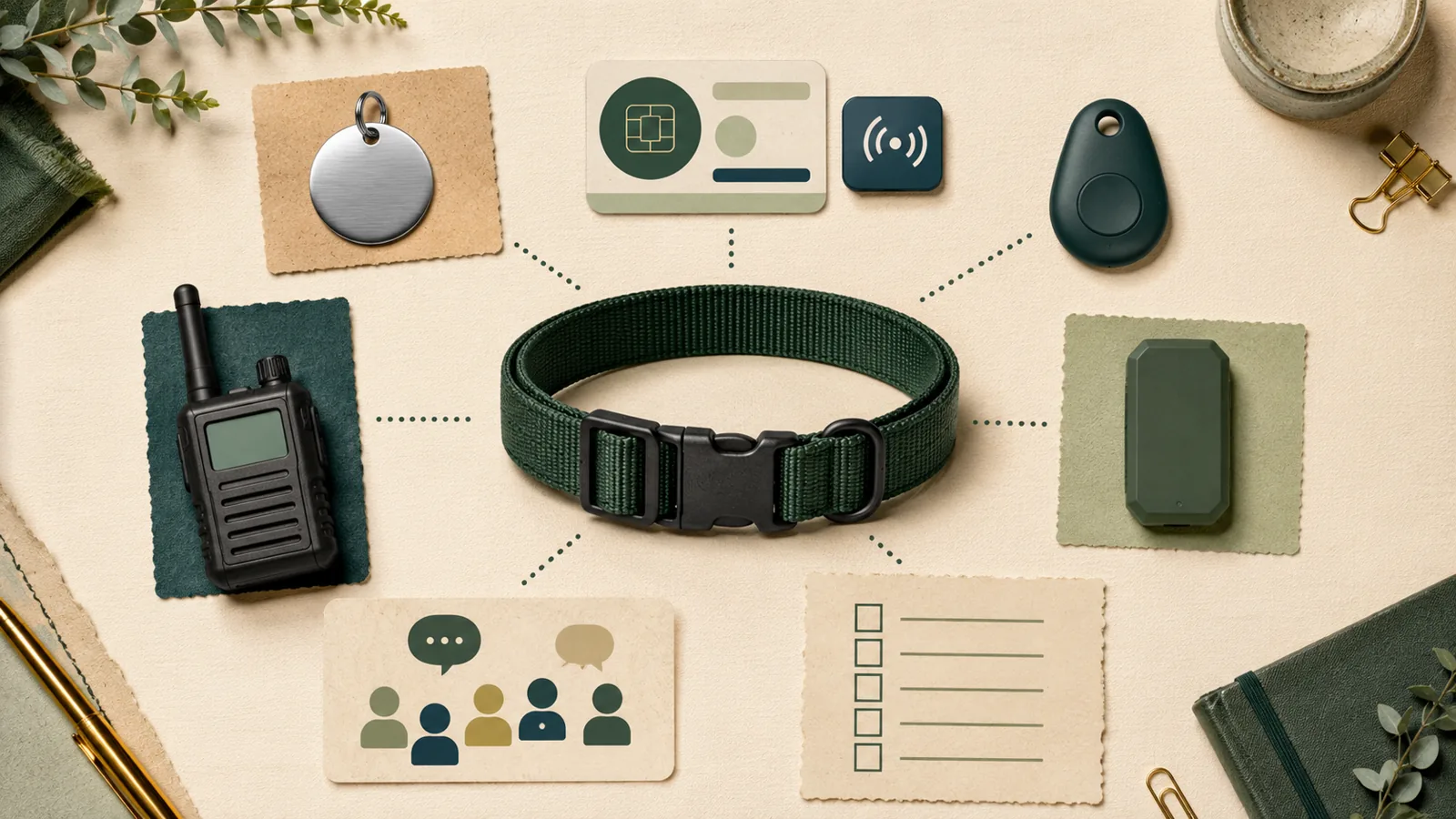
An alternative to a pet GPS tracker can replace only the job it is designed to do. A current ID tag can help a finder contact you, a registered microchip can preserve identity if a collar is lost, a Bluetooth tag can add conditional nearby or crowd-assisted detections, a dedicated radio system can support active off-grid tracking, and community reporting can widen a search. None of those layers alone reproduces every wide-area cellular GPS function, and no single layer in the reviewed evidence covers all identification, location, and search jobs.
Start by naming the required job, then expose what remains uncovered. A layered plan is usually more honest than calling one tool a complete replacement.
Key facts
Swipe horizontally to see all columns.
| Question | Evidence-safe answer |
|---|---|
| What is the simplest contact layer? | A current personalized collar tag, provided it remains attached and legible. |
| What survives collar loss? | A registered microchip can preserve identity after a compatible scan and registry workflow. |
| Can a Bluetooth tag replace GPS? | No. It can add nearby or crowd-assisted item finding, but it depends on platform compatibility and third-party detections. |
| What can work away from cellular service? | A compatible dedicated radio collar and receiver can provide active location under usable radio conditions. |
| Does “no subscription” mean the same capability? | No. Removing a recurring service can also remove wide-area cellular delivery or shift cost and complexity to separate equipment. |
| Is any layer a recovery guarantee? | No. Attachment, registration, power, route conditions, platform participation, finder actions, and current records still matter. |
The important comparison is not “GPS versus no GPS.” It is which recovery jobs remain covered after a layer is removed.
Start with the job, not the product label
“Tracker,” “tag,” and “GPS” are often used as if they describe one job. They do not. The underlying layers can identify a recovered dog, help with a nearby search, use other people’s compatible devices, send positions to a dedicated receiver, send positions through a cellular network, or amplify a public search.
The Pet Signal Guide location-technology explainer describes how GNSS, cellular, Wi-Fi, Bluetooth, and microchips fit together. For this decision, write down the required job before choosing a layer:
If a cellular tracker remains in scope, use the dog GPS tracker buyer’s guide to compare that path against the alternatives below.
- Immediate contact: a finder can read current owner contact information.
- Collar-independent identity: identity can be recovered after a scan even if the collar is gone.
- Nearby finding: a compatible phone or receiver helps locate a nearby attached device.
- Crowd-assisted location: third-party compatible devices can relay detections.
- Off-grid active tracking: a powered radio collar sends location to compatible receiving equipment without cellular service.
- Wide-area remote location: the device sends positions through cellular service to an app.
- Search amplification: a current profile, shelter records, posts, alerts, and posters expand the number of people looking.
Visible ID tags provide the fastest contact path when they stay attached
A personalized collar tag can let a finder call or message the owner without a scanner, account, app, or network. The ASPCA’s identification position supports pairing visible identification with a microchip rather than treating the two as substitutes. AAHA identification guidance also emphasizes current collar identification and current microchip records.
The dependency is simple but material: the tag must remain with the dog, be readable, and contain current information. Collar loss is therefore a shared failure for a visible tag and any tracker mounted on the same collar.
What it replaces
Visible ID can replace a more complex system when the only required job is immediate finder-to-owner contact after a person has already found the dog.
What it does not replace
It does not locate a dog, survive collar loss, or notify the owner before a person reads the tag.
A registered microchip preserves identity, not location
A microchip can provide collar-independent identity after a compatible scanner reads the chip and the registry trail reaches current owner details. The AAHA registry lookup identifies participating registries for a scanned chip number; it does not expose owner details or update the registration itself.
Registration and maintenance are part of the system. AAHA advises keeping contact details current and periodically confirming that the chip can be detected. AAHA also states that microchips are not fail-safe.
What it replaces
It can preserve identity when a collar or external device is missing.
What it does not replace
A microchip does not broadcast a dog’s position, send an escape alert, or guide the owner to a moving dog. A finder or organization must scan it and follow the registry process.
Bluetooth tags add nearby or crowd-assisted finding with platform conditions
Apple positions AirTag for personal items in the Find My ecosystem. Google’s Find Hub accessory specification describes Bluetooth Low Energy broadcasts, encrypted crowd-network handling, compatibility rules, and anti-tracking requirements. These are item-finding architectures, not continuous pet GPS evidence.
A Bluetooth tag can provide two useful functions:
- nearby finding with a compatible phone and supported tag capabilities;
- crowd-assisted detections when other compatible devices encounter the tag and the platform relays a location.
That second function is conditional. The reviewed evidence did not measure how many compatible devices pass a route, how quickly a detection is relayed, or how platform settings affect a particular search.
Privacy behavior is part of the product behavior
Apple documents unwanted-tracking alerts, sounds, nearby finding, and disable steps. Google documents unknown-tracker alerts and related protections. A comparison that ignores those protections is incomplete; they can change how an item tag behaves around people who do not own it.
What it does not replace
A Bluetooth crowd tag does not provide a dedicated off-grid receiver, guaranteed crowd density, continuous cellular telemetry, or collar-independent identity.
Dedicated radio trackers can support active location without cellular service
A dedicated radio system uses a powered collar device and compatible receiving equipment. It can be relevant when the required job is active location in an area where cellular service is unavailable or unacceptable.
Current tracking-only examples include Garmin Alpha T collars paired with compatible Alpha handheld equipment and Dogtra PATHFINDER2 TRX tracking-only variants. Garmin’s current product documentation distinguishes tracking-only Alpha T collars from training-capable variants. Dogtra’s PATHFINDER2 documentation describes downloaded maps, a radio connector/app architecture, and no required cellular service during use.
Garmin and Dogtra publish maximum range or battery figures for selected systems. Those are attributed vendor claims, not route measurements. Terrain, vegetation, interference, equipment placement, power, frequency rules, and exact model compatibility can change the result.
What it does not replace
A radio collar does not preserve identity after collar loss, eliminate receiver/equipment dependencies, or guarantee its maximum range. It also does not automatically provide the same household sharing or remote-app behavior as a cellular service.
Cellular GPS still provides a different wide-area delivery layer
A cellular GPS tracker combines position estimation with a cellular path to an app. That architecture can support wide-area remote location without the owner carrying a dedicated radio receiver near the search area. It also creates dependencies: battery, account/app operation, cellular service, route conditions, and usually a service plan.
The FCC explains that mobile-coverage maps are modeled outdoor or in-vehicle representations and that actual experience can vary. A map is therefore a screening tool, not proof that a pet tracker works indoors or along every route.
Removing a subscription can be a valid household constraint. It does not make a passive ID layer or a crowd tag functionally equivalent to wide-area live location.
Community recovery networks amplify a search without creating telemetry
Petco Love Lost describes a free national lost-and-found database with image matching, shelter-partner records, alerts, and printable posters. Best Friends guidance for a found pet includes neighborhood checks, community reporting, flyers, and a microchip scan.
This layer can widen the number of people and organizations comparing a dog or photo against current records. It does not generate a device location or guarantee that a record is seen or matched.
Use a scam-aware communication path
Petco Love Lost advises limiting unnecessary personal details, using protected platform messaging, asking for proof, and avoiding payment or verification-code pressure. No workflow eliminates fraud, and local shelter or animal-control requirements may add steps that are outside this technology guide.
Compare the layers by job and dependency
Swipe horizontally to see all columns.
| Layer | Primary job | Active location? | Key dependency | Important uncovered job |
|---|---|---|---|---|
| Personalized ID tag | Immediate contact | No | Current legible tag remains attached | Location before a finder reads it |
| Registered microchip | Identity after a scan | No | Compatible scan, registry trail, current record | Remote or nearby location |
| Bluetooth crowd tag | Nearby/crowd-assisted item finding | Conditional | Compatible platform, settings, third-party detections | Off-grid active tracking and identity after collar loss |
| Dedicated radio tracker | Off-grid active location | Yes | Exact collar, receiver/connector, power, radio conditions | Collar-independent identity |
| Cellular GPS tracker | Wide-area remote location | Yes | Power, service, route, account/app | Identity after collar loss |
| Community recovery network | Search amplification | No telemetry | Current profile, participation, safe communication | Direct device location and permanent identity |
A lower-complexity layer may reduce one dependency while adding a different one. “No subscription” can still require separate receiving equipment, third-party detections, or finder participation.
Swipe horizontally to see all columns.
| Failure or unknown | Layers affected | Evidence-safe response |
|---|---|---|
| Collar or mount is lost | ID tag, Bluetooth tag, radio collar, cellular GPS | Keep collar-independent identity as a separate layer. |
| Contact or registry details are stale | ID tag, microchip, community profile | Update records on a recurring schedule and after contact changes. |
| Power is depleted | Bluetooth, radio, cellular GPS | Verify charge status and preserve passive identity layers. |
| Network or route is unsuitable | Bluetooth crowd, radio, cellular GPS | Keep the result conditional until the actual route is checked safely. |
| Finder or community does not participate | ID, microchip, community network, crowd network | Use multiple independent layers rather than assuming participation. |
| Platform/model rules change | Bluetooth, radio, cellular, community platform | Recheck exact current documentation before relying on the workflow. |
Every recovery layer has a different failure pattern. Preserve at least one identity path that does not depend on the same collar, battery, network, or account as the location layer.
Choose by scenario, not by a universal winner
Swipe horizontally to see all columns.
| Scenario | Useful layer or combination | What remains uncovered |
|---|---|---|
| Finder already has the dog | Current ID tag plus registered microchip | No help locating the dog before recovery |
| Nearby search in a compatible phone ecosystem | ID, microchip, and a compatible Bluetooth tag | Crowd density, detection time, collar retention and continuous tracking |
| Remote area with unreliable cellular service | ID, microchip, and an exact compatible dedicated radio system | Maximum range, interference, attachment, battery and receiver proximity |
| Wide-area route with acceptable cellular service | ID, microchip, and a cellular GPS layer | Route-level coverage, latency, battery, app/service and collar loss |
| Household rejects recurring service | ID and microchip, with Bluetooth or radio only if their jobs fit | Wide-area remote cellular delivery may remain uncovered |
| Dog is already missing | Current identification records plus shelter/neighborhood/community search | No layer guarantees a detection, scan, match, or return |
Choose the row that matches the real recovery scenario, then record the uncovered job instead of describing the selected layer as a complete replacement.
Build a layered plan around independent failure modes
A robust plan does not depend on every layer failing in the same way. Collar-mounted electronics and a collar tag share collar-loss risk. A microchip does not share that attachment failure, but it depends on a scan and registry workflow. Community records do not share device-battery failure, but depend on participation and current information.
Swipe horizontally to see all columns.
| Plan layer | Job | Maintenance question | Failure not solved |
|---|---|---|---|
| Visible ID | Fast contact | Is the tag legible and the contact current? | Collar loss |
| Microchip | Collar-independent identity | Is the registration current and has detection been confirmed? | No remote location |
| Chosen location layer | Nearby, off-grid, or wide-area location | Does the exact architecture fit the route and household? | Coverage, attachment, power, or platform unknowns |
| Recovery profile | Search amplification | Are recent photos, contact details, and records ready? | No telemetry or match guarantee |
The layered plan is useful only when its components fail differently. Keep visible contact, collar-independent identity, the chosen location layer, and current recovery information as separate maintenance jobs.
When no cellular GPS tracker may be reasonable
A household may reasonably decide against cellular GPS when it does not need wide-area remote location, rejects the service dependency, cannot verify the route, or chooses an off-grid radio architecture that better fits a defined search environment.
That decision should be explicit:
- identify which live-location job is being declined;
- keep visible and collar-independent identity current;
- record whether nearby, crowd-assisted, radio, or community layers remain available;
- do not call an uncovered job “solved” merely because another layer is cheaper or simpler.
What the alternatives do not replace
- A collar tag does not provide location before a finder reads it.
- A microchip does not transmit location.
- A Bluetooth crowd tag does not create guaranteed or continuous coverage.
- A dedicated radio system does not remove collar, receiver, power, compatibility, frequency, or route dependencies.
- A community database does not provide telemetry or guarantee a match.
- A cellular GPS tracker does not replace visible identification or collar-independent identity.
No reviewed layer establishes safe fit, comfort, recovery probability, location accuracy, alert latency, real-world range, battery life, waterproof performance, durability, or long-term support.
What to verify before relying on a layer
Swipe horizontally to see all columns.
| Layer | Verify now | Recheck trigger |
|---|---|---|
| Visible ID | Legibility, attachment, current phone/contact route | Contact or collar change; visible wear |
| Microchip | Registration, current details, registry path, detectable chip | Move, phone/email change, adoption/ownership change |
| Bluetooth tag | Exact phone/tag compatibility, account/settings, battery, anti-tracking behavior | Phone, OS, country, platform or tag change |
| Radio system | Exact collar/receiver compatibility, power, frequencies, maps and route conditions | Model, firmware, region, route or equipment change |
| Cellular GPS | Exact network/service, app/account, route, battery and plan | Carrier, route, app, firmware, plan or renewal change |
| Community profile | Recent photos, contact details, safe communication route, local partner records | Appearance/contact change or platform-policy change |
A layer is not ready merely because it was purchased. Verify its current records, compatibility, power, account, route, and recovery workflow on a recurring schedule.
What we could not verify
- how often a tag remains attached, legible, noticed, scanned, or acted upon;
- microchip scan prevalence, registry response time, or recovery rate;
- Bluetooth crowd density, detection time, platform delivery, or pet-use reliability;
- real radio range, interference, route performance, attachment retention, battery life, or regulatory suitability;
- cellular tracker coverage, latency, battery, app uptime, or recovery outcomes;
- lost-and-found database match rates or complete shelter participation;
- safe attachment, comfort, durability, waterproofing, or suitability for any dog;
- current complete cost, shipping, tax, replacement timing, or long-term support for any alternative;
- a complete United States product universe or one best alternative.
Method
This guide uses a versioned Pet Signal Guide job-coverage method. It maps six recovery layers against seven jobs and reports each required job as supported, conditional, or uncovered. It does not assign weights, scores, ratings, or a winner.
The retained validation suite contains 18 regression scenarios, 18 rejected invalid inputs, 500 deterministic property cases, JSON Schema validation, repeated-output checks, selected-layer order independence, and capability invariants. These synthetic tests validate the method’s logic. They do not test a dog, product, route, registry, platform, shelter, or recovery outcome.
Evidence was checked on July 25, 2026. Current platform, model, compatibility, frequency, network, and policy records must be rechecked before publication.
Sources
- American Animal Hospital Association: Animal identification and microchipping
- American Animal Hospital Association: Microchip Registry Lookup
- ASPCA: Position Statement on Pet Identification
- ASPCA: Disaster Preparedness
- Best Friends Animal Society: What to do if you have found a lost or stray pet
- Best Friends Animal Society: How to find a lost pet
- Petco Love Lost: What is Petco Love Lost?
- Petco Love Lost: How to avoid a lost-pet scam
- Apple: Use AirTag and Find My to keep track of personal items
- Apple: Set up an AirTag
- Apple: Unwanted AirTag or Bluetooth tracker guidance
- Google: Find Hub Network Accessory Specification
- Google: Locate lost belongings with Find Hub
- Google: Android unknown-tracker alerts
- Garmin: Alpha 200 Plus system and compatible tracking collars
- Garmin: Alpha T 20 specifications
- Garmin: VHF radio information
- Dogtra: PATHFINDER2
- Dogtra: PATHFINDER2 TRX tracking-only receiver
- Federal Communications Commission: What’s on the National Broadband Map
- Pet Signal Guide: How Pet Location Technologies Work